SAN ANTONIO — Alright San Antonians winter is coming! A polar front is set to arrive and bring the coldest temperatures we've seen this season. We are talking about a significant temperature swing where you will want to cover the plants and watch the pipes.
This weather will almost sneak up on San Antonians as mild to seasonal temperatures will be setup before this arctic blast comes into place. So mark your calendars especially if you have plans for MLK Day you'll want get those big coats ready for what's to come.
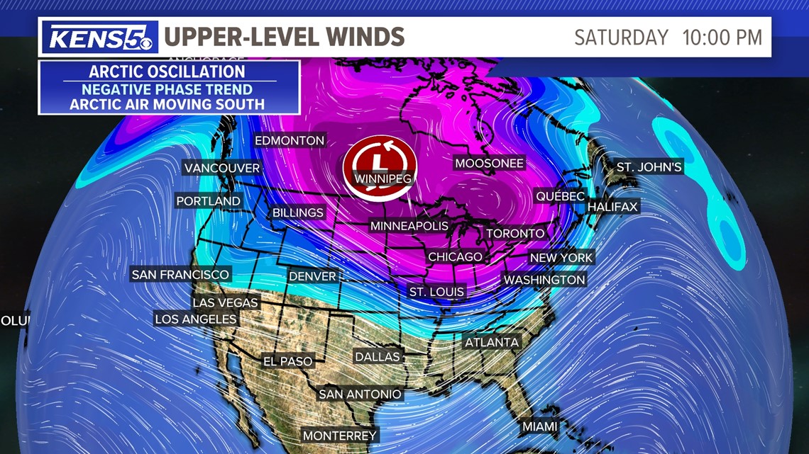
The exact timing of this polar front is still unclear but it's important to know that weather will drop and could hang around for multiple days with below-freezing temperatures. In addition there could be wind chill temperatures possible in the teens. Brrr..!
Over the next seven days San Antonio will experience two fronts. The first one will bring strong winds and the second front will bring the arctic blast.
Here's what San Antonians should expect this week:
Wednesday- Thursday: South flow will stay in place allowing a warming trend of high temperatures before our first cold front of the week. High temperatures for Wednesday and Thursday will be in the 70s with plenty of sunshine. However morning temperatures will still be chilly in the 30s on Wednesday morning and the 40s on Thursday morning.
Friday: The first front will arrive during the morning hours so get those warm clothes ready the night before. This front will bring a near 20-degree drop from Thursday to Friday. Highs on Friday will be in the 50s and lows in the 40s. It will be sweater weather all day.
Another thing to expect with this front is the winds. Expect winds to pick up around 20-30 mph with possible 45 mph wind gusts and we are not expecting shower activity. This will lead to a possible Red Flag Warning (fire danger) due to high winds.
Weekend: Dry air will be in place after the first cold front dropping morning temperatures in the 30s but quickly warm-up to the 60s by the afternoons on Saturday and Sunday. The strong winds from Friday will also have died down so expect beautiful weather for the weekend until Sunday night. Late Sunday unto Monday morning an arctic air mass will arrive to San Antonio.

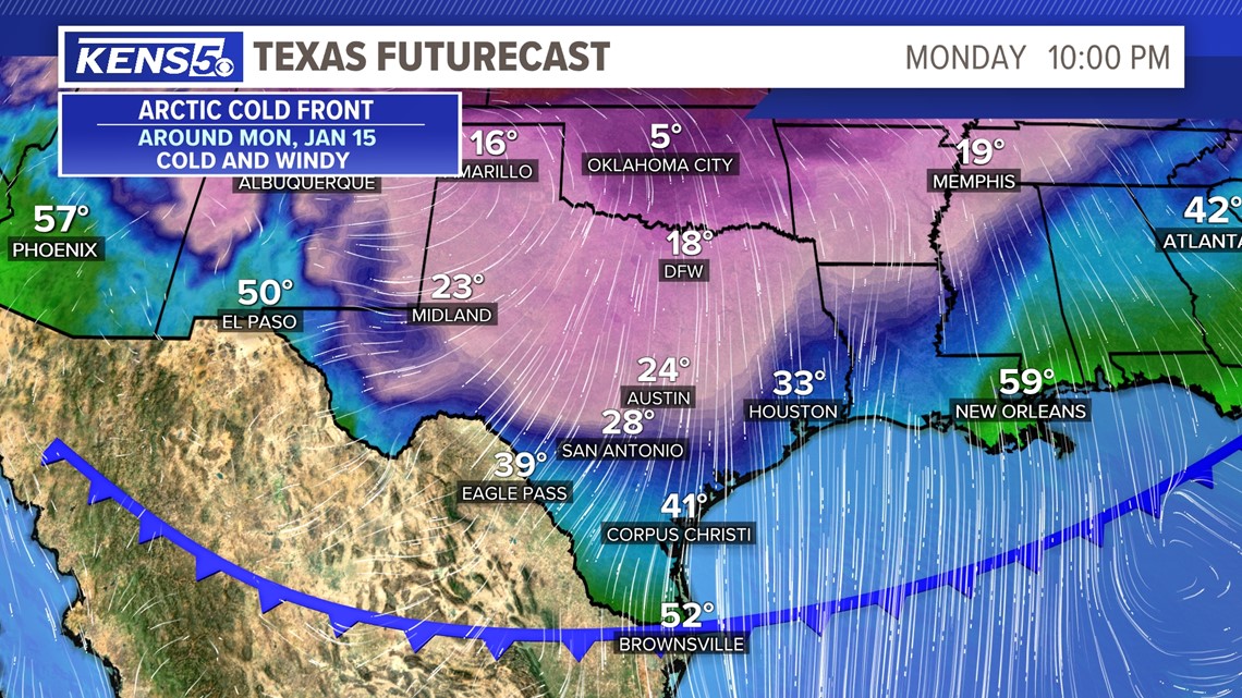
MLK Day: This is the day you'll want to bundle up with big jackets, scarves, hats, etc. An arctic blasts should arrive early Monday morning and begin dropping temperatures. After this front high temperatures will not go above the 30s and evening temperatures will drop in the 20s. Brrr..!
Some weather models are showing precipitation which could produce a wintry mix but it's too early to tell. At this time we will keep the forecast dry but continue to fine tune any details as we get closer.
One thing that is for certain is this arctic blast will bring frigid cold temperatures so be prepared if you plan to head to the MLK March. Dress in warm clothes and keep them nearby because this cold weather could last for multiple days with wind chill temperatures in the 20s. Get ready in case you have plans for early next week.