
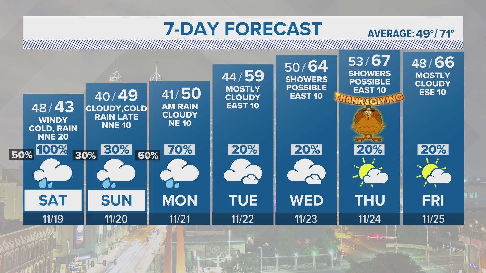
SAN ANTONIO — Keep those sweaters and big jackets nearby as another shot of cold air moves through San Antonio keeping temperatures well below-average this weekend.
A front will push through the city that will mix with moisture this weekend increasing chances of rain for San Antonio and possible sleet for the Hill Country.
Many north Texas cities are already feeling the effects of this colder weather with much of the panhandle staying below freezing this afternoon.
Thanksgiving in the Alamo City looks to be mostly rain-free but the forecast could still change as we get closer to the holiday.
Here's what you need to know:
Saturday (High 42 and Low 41): A cloudy morning is expected with light shower activity for most of the day. By the afternoon winds ahead of the front will pick-up near 25 mph. This will allow wind chill values to feel like temperatures are in the 30s. So bundle up for those outdoor plans!
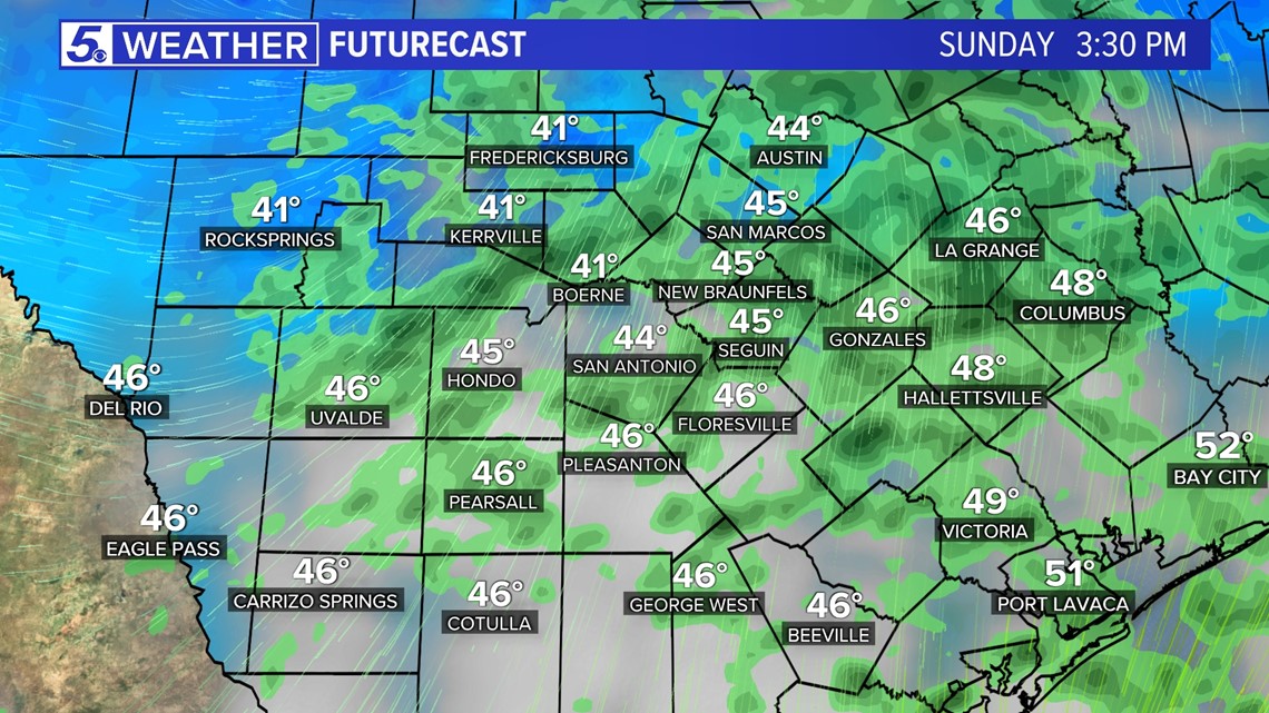
As the front passes rain will continue in San Antonio and some models are showing low chances of a rain/sleet mix possible in the Hill Country. Temperatures will also stay in the 40s all day. Brrr...!

By late evening rain should begin to diminish and temperatures will drop overnight into the 30s for the Hill Country and stay in the 40s for San Antonio.
Sunday (High 49 and Low 40): Light rain and cold temperatures will continue before another system rolls through San Antonio Sunday night. A band of showers are possible overnight Sunday into Monday morning.
Monday (High 50 and Low 41): Some heavier showers and storms are are also possible through the afternoon but location will vary. Rain chances drop as we get closer to the evening.
Rest of the week: Active weather pattern hangs around keeping a 20 percent chance of rain for the rest of the week. Temperatures will gradually rise back up to the mid-60s by Wednesday but stay below-average.
Thanksgiving day another cold front is scheduled for the afternoon pushing in drier air behind. Currently partly cloudy skies are in store with high temperatures at a very comfortable 66 degrees and low temperatures in the 50s.