SAN ANTONIO — A couple of factors are in play for San Antonio to get rain, possible isolated strong to severe storms and gusty winds on Monday.
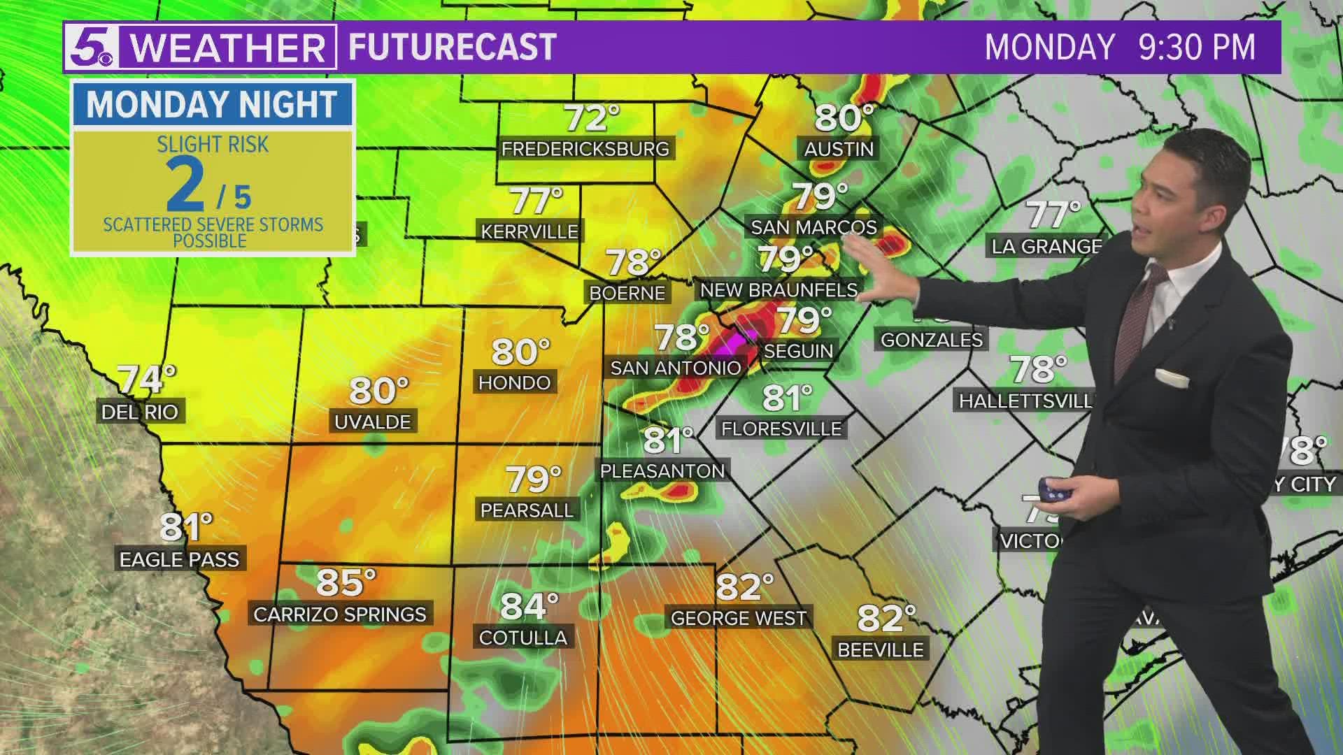
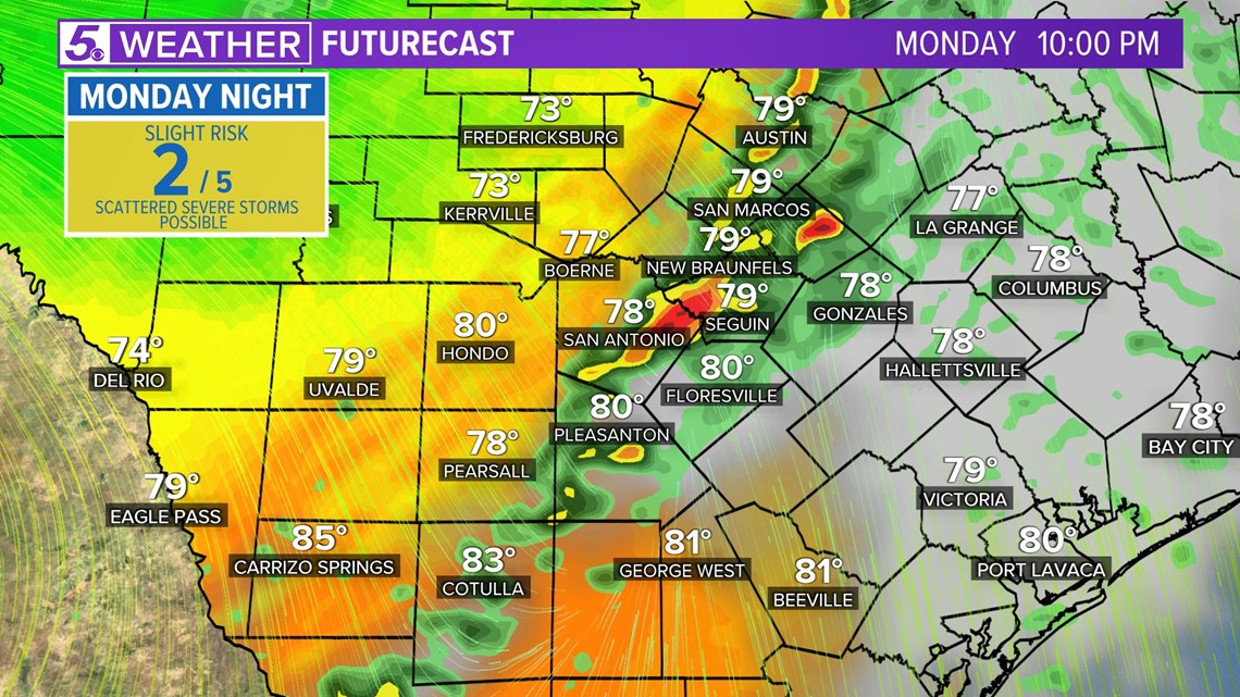
As a cold front, upper-level system, and remnants of Tropical Storm Roslyn head our way San Antonians will also get another taste of cooler weather. Due to this combination the Storm Prediction Center has placed San Antonio in a slight risk (level 2 of 5) for severe weather Monday evening.
San Antonio will have two chances for rainfall next week helping to bring some chilly morning temperatures.
Here's what to expect over the next 5 days:
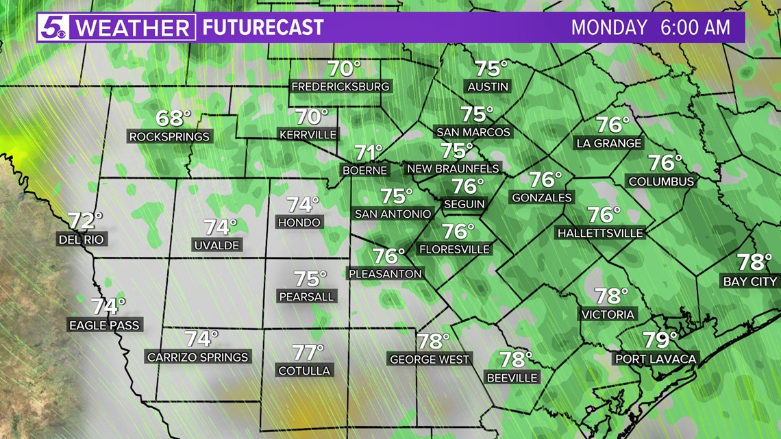
Monday (High 87 and Low 74): Light showers are expected across the region early morning. Remnants of Tropical Storm Roslyn will also help by pumping additional moisture our way. San Antonians should see a break from rain during the afternoon before more rain/storms arrive Monday evening when the cold front slides into our area.

Scattered storms are possible with some isolated pockets that could become severe. These pockets of rainfall could producing 1-2 inches of rainfall. Currently the threat for flooding is low.
Monday night you might want to deflate or tie down those Halloween decorations as damaging winds and hail are possible with stronger storms. The rain/storms will move through San Antonio around 6 p.m. - 9 p.m.
By 10 p.m. the front should be to the east of San Antonio leaving behind breezy winds and cooler temperatures.

Tuesday (High 77 and Low 55): San Antonians will wake up to temperatures in the mid 50s and a breezy north wind up to 35 mph so you will want to wear a jacket! Plenty of dry air and sunshine will warm us up in the upper 70s by afternoon.
Wednesday (High 79 and Low 50): Another chilly start to the morning with temperatures colder than Tuesday in the low 50s and some spots in the Hill Country could reach the 40s! Best to dress in layers if starting early Wednesday because afternoon highs will be near 80 degrees.
A southeasterly wind will also return allowing humidity back during the day. This could help our rain chances Thursday.
Thursday (High 81 and Low 54): An upper-level system will move through our region late Thursday into Friday morning. Currently, San Antonio has a 40 percent chance of rain/storms as another front moves through overnight Thursday.
Friday (High 78 and Low 62): Rain will be present but should clear out Friday night.
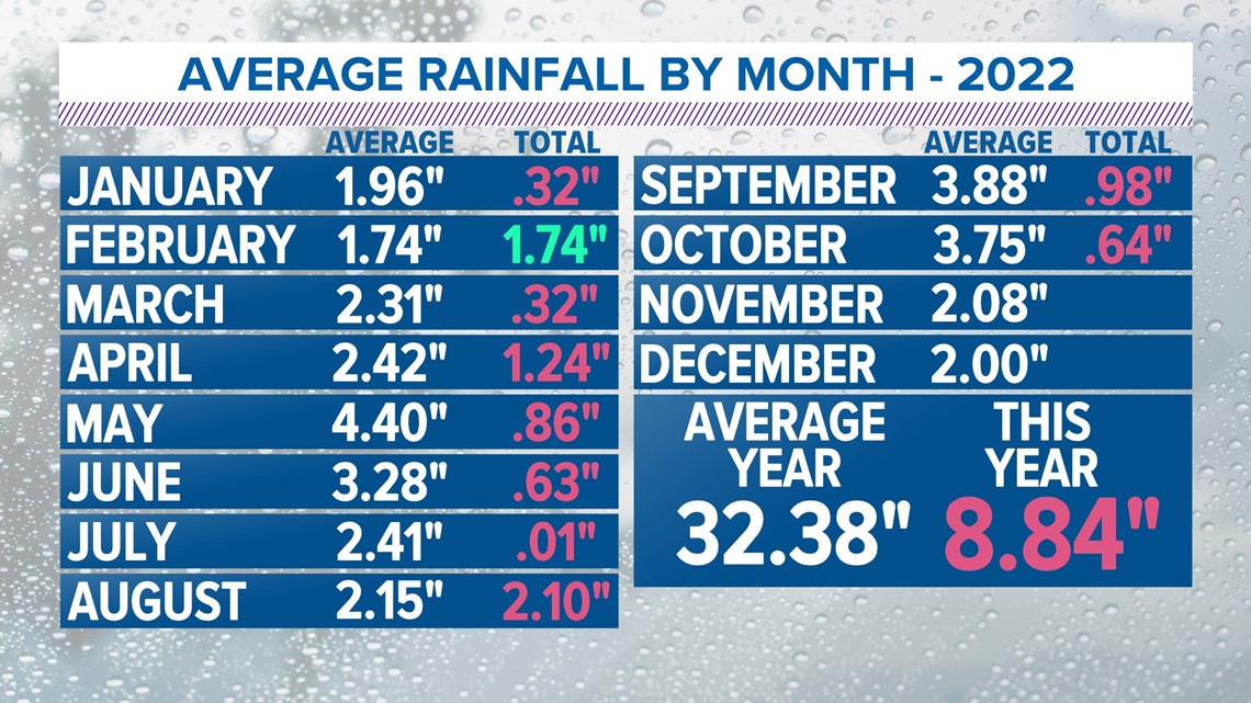
San Antonio is still below average for rainfall this year. So fingers crossed we will receive some measurable rainfall with these next two fronts.