SAN ANTONIO — San Antonians can finally start planning out their warmer holiday attire due to a series of cold fronts that will drop temperatures 10 degrees below average over the next seven days.
This comes after San Antonians endured multiple days of spring-like weather, humid air and foggy mornings.
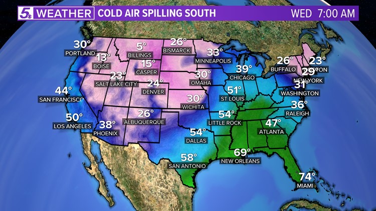
After the first front moves through Tuesday evening colder air will slowly grip Texas allowing low temperatures to cool as low as the upper 30s as the week progresses.
Here's what you need to know about San Antonio's next cold pattern:
Wednesday (High 66 and Low 51): Drier air will filter in behind the front along with possible shower activity through mid-morning. Little rain accumulation is expected. Take a jacket for the morning as temperatures will only by in the 50s.
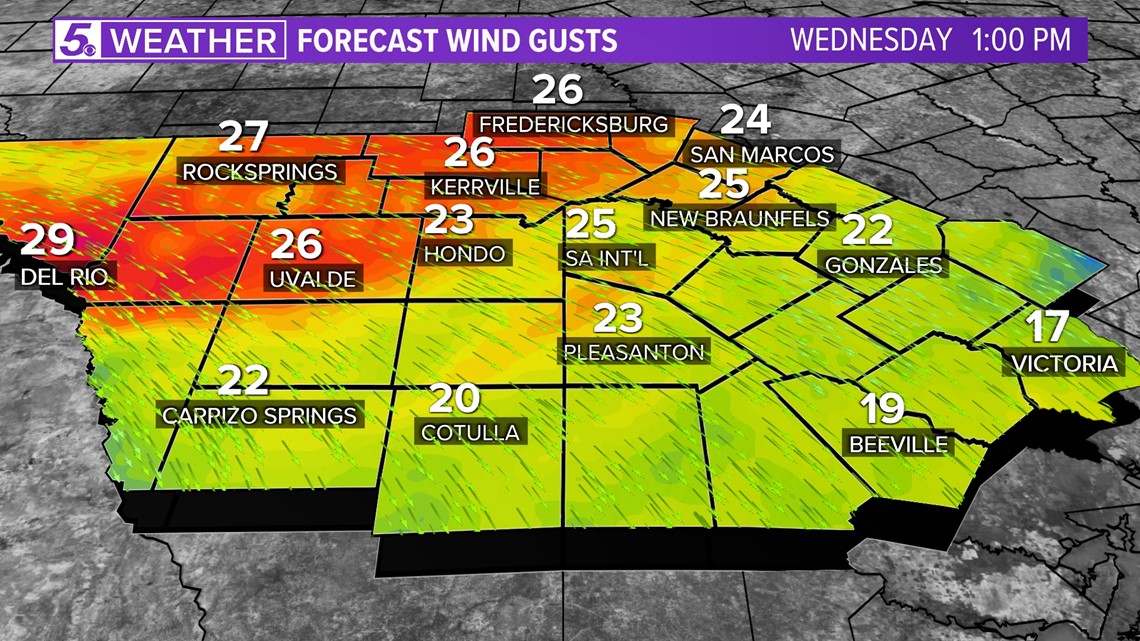
Breezy conditions with wind gusts up to 30 mph are also expected through the afternoon so tie down those holiday decorations before you leave for work.

Plenty of sunshine will allow for a beautiful afternoon with high temperatures very comfortable in the mid 60s. San Antonians will not see any major drop in afternoon temperatures until Friday.
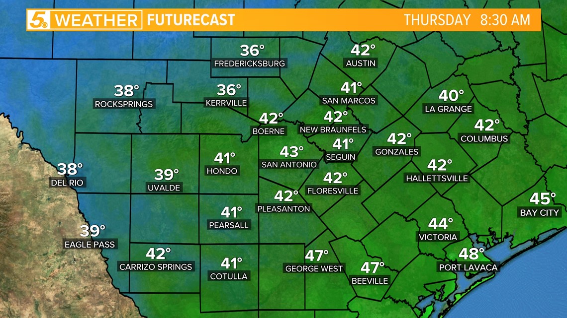
Thursday (High 65 and Low 40): A high pressure will take hold of San Antonio's weather pattern allowing for an afternoon much like Wednesday but after sunset temperatures will drop into the low 40s. Dress warm if you plan to be out late.
A second push of colder air will sink into Bexar County by the evening allowing for cold weather to hang on through the weekend.

Friday (High 58 and Low 38): Sweater weather day is here! High temperatures will trend near 10 degrees below average with high temperatures in the upper 50s and overnight lows dropping in the upper 30s.
Weekend: Another upper-level system will roll into our area creating a cold and possible rainy weather pattern that hangs around through Sunday. No need to cancel any outdoor plans at the moment but you may want to dress warm.
High temperatures are expected to remain chilly through the weekend with highs in the mid 50s and low temperatures dropping down into lower 40s through Sunday.
Next Week: Humidity will return on Monday bringing a 30 percent chance of rainy conditions and a return to average temperatures.
Tuesday another cold front could move into our area bringing another 10 degree drop, however this is still a couple days away and will continue to update more specific details.
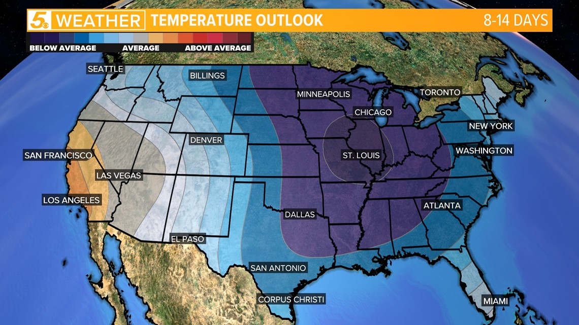
Christmas Day: Looking further into the future (10-12 days out) on Christmas Day some models indicate below-average weather. This will certainly add to the holiday spirit but at 10 days away the accuracy on some weather models are still low.