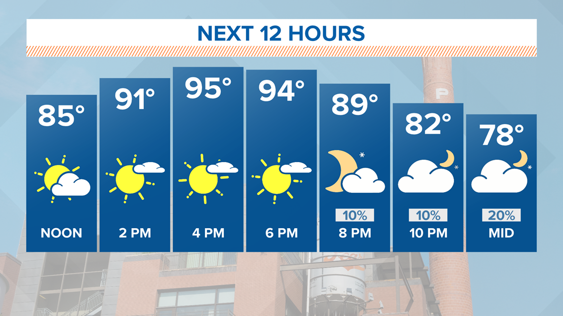
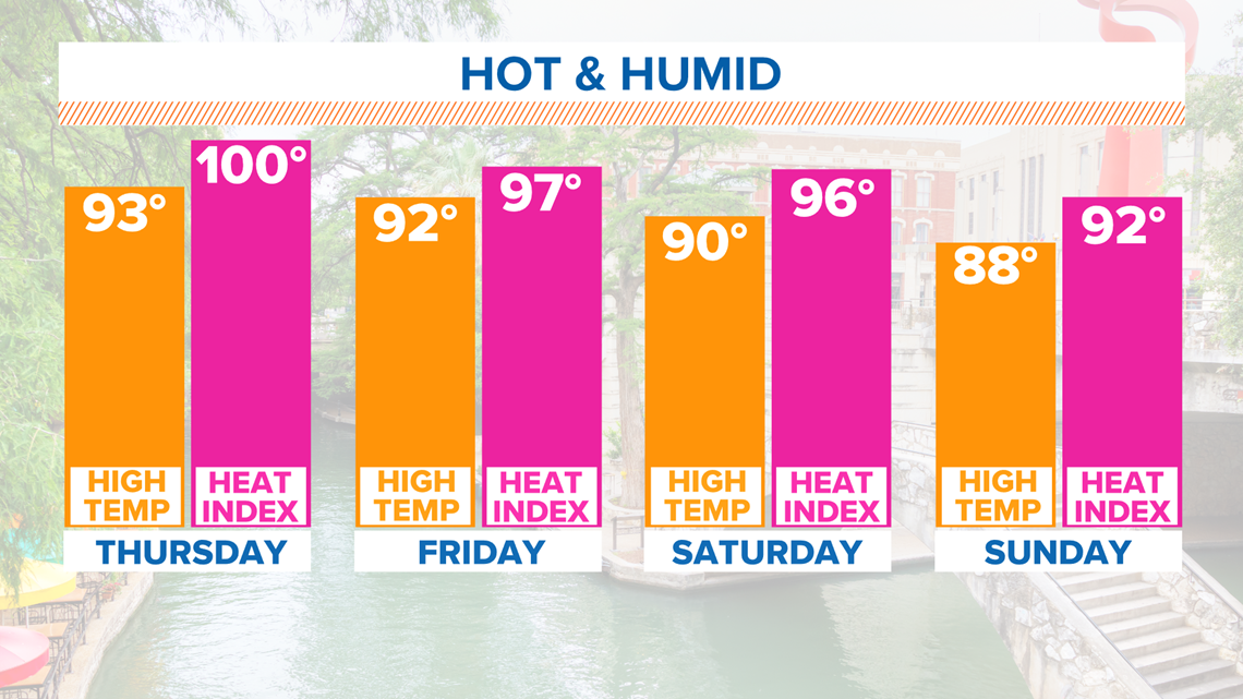
SAN ANTONIO — Get ready for another hot and humid afternoon! Temperatures will soar into the mid to upper-90s with heat indices in the triple digits for most communities on Wednesday.

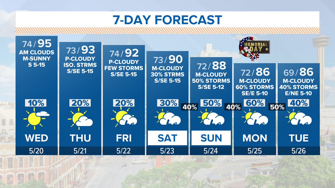
Rain chances will increase tonight for the Rio Grande and the Hill Country. In fact, some of our western counties are under a level 1 marginal risk. This means isolated severe thunderstorms are possible late afternoon into tonight.
Primary threats will be hail and strong wind gusts.

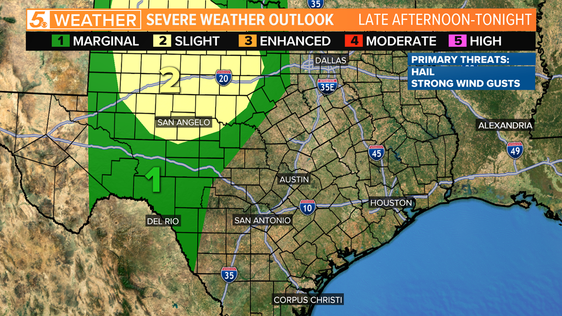
We will keep higher rain chances west of San Antonio this evening. A few isolated showers may move into Bexar County after midnight when most of us are asleep. There will be a strong cap in place, which is why rain chances are remaining pretty slim for South Texas.
RELATED:
More waves of showers and thunderstorms are likely over the holiday weekend. Temperatures will fall a bit while rain chances and clouds increase over South Texas.
The best chances for rain will be Sunday and Memorial Day.

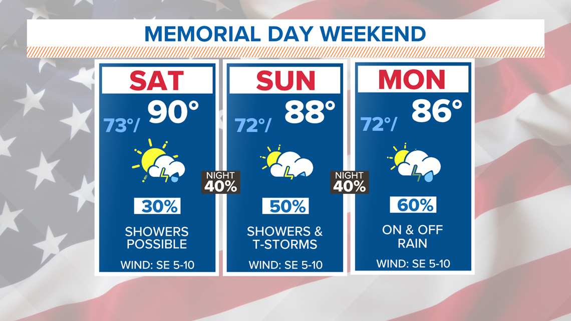
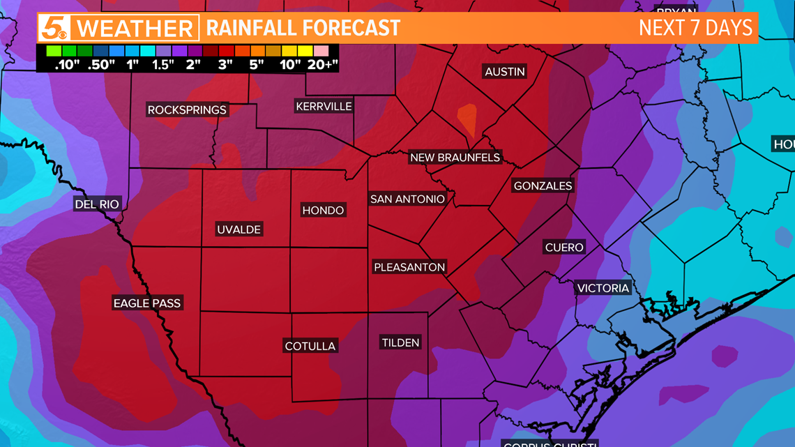
Over the next seven days, most counties could receive two to three inches of rain with locally higher amounts. Isolated flooding will be possible over the weekend, and make sure to watch for lightning if you have any outdoor activities planned.

The humidity will stick around for several days. Triple-digit heat indices are likely again on Thursday.

Beyond Memorial Day, additional scattered showers and thunderstorms are possible on Tuesday.

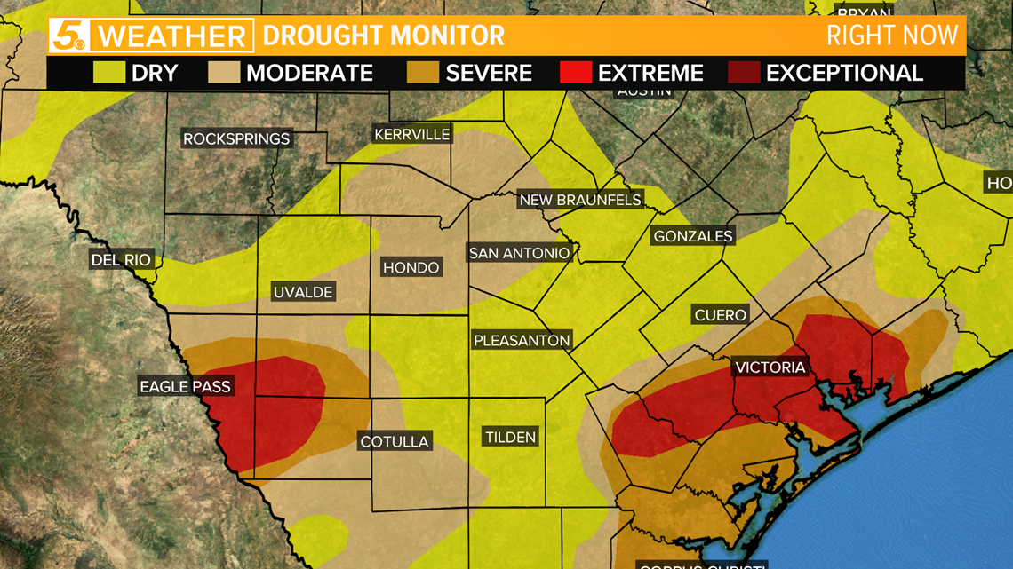
This is good news for South Texas with most areas still suffering from drought and below normal rainfall.

Don't forget you can download the KENS 5 app for the latest news and weather information each day while you are on the go.
PEOPLE ARE ALSO READING: