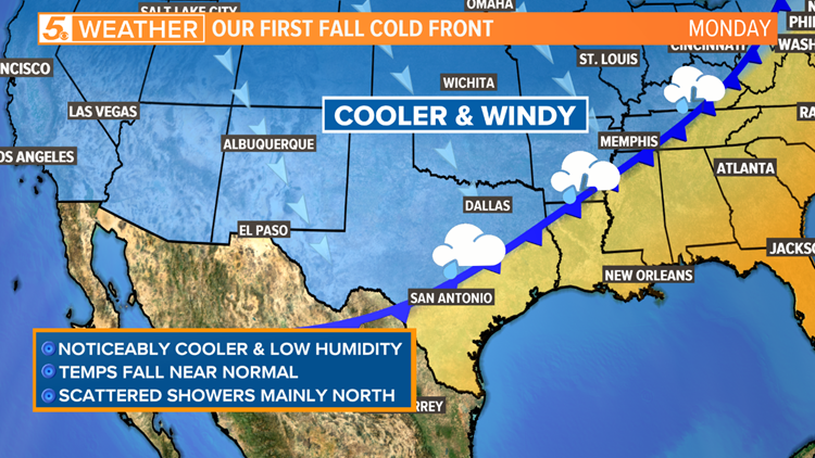
It looks like summer will loosen its grip on Texas early next week!
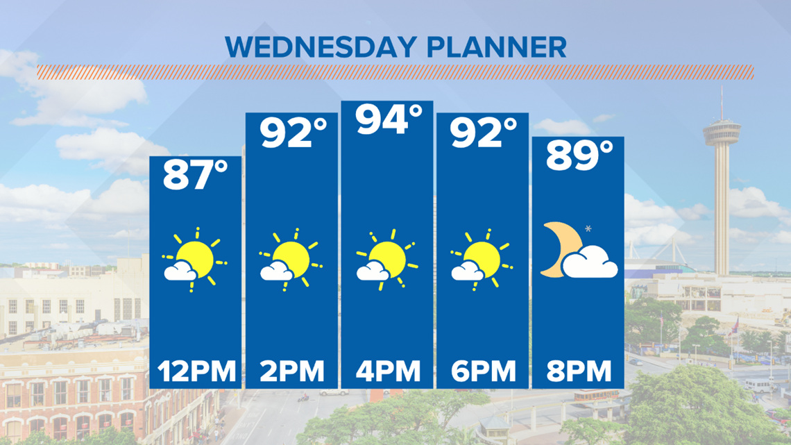
Our first real fall cold front of the season should arrive during the day on Monday. Hang in there. Temperatures will still climb into the low to mid-90s this afternoon with a heat index of 98 degrees. Temperatures will be a few degrees shy from record again today. Afternoon isolated showers are also possible today, but most of us will stay dry.

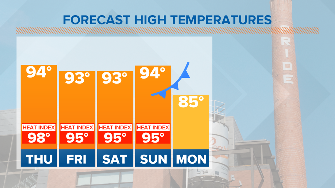
Before the cold front, it will be hot and humid over the next several days. Forecast high temperatures will be well above normal.

By Monday, we should notice the cold front moving through our area. Our wind will pick up with gusts up to 30 mph possible in some communities. Humidity will gradually drop along with temperatures during the day on Monday.


Rain is possible along the cold front, but the highest rain coverage will be north of San Antonio. Not ruling out a few spotty showers for north counties Monday morning into the afternoon.
It should be noticeably cooler late Monday into Tuesday. Low temperatures may fall into the upper-50s to low-60s in many neighborhoods. High temperatures will be more fall-like in the low to mid-80s.
Keep in mind that this cold front is still several days out. Timing and temperatures may change as new forecast updates are released. The KENS 5 weather team will iron out the details on-air and online this week.