SAN ANTONIO — First up, the good news: Frozen precipitation is over.
But below-freezing temperatures will stick around for the next three days. That's why the National Weather Service has extended an ongoing Winter Weather Advisory for the region through 10 a.m. Friday. NWS officials have also issued a Wind Chill Advisory beginning 9 p.m. Thursday and lasting until 9 a.m. Friday.
The extension is due to roads remaining dangerous thanks to icy spots and the development of black ice where roads were wet after wintry precipitation ended Thursday afternoon. Wind-chill temperatures will also remain cold as the advisory begins in the evening.
So why does the wind advisory include just one night? That's when the coldest temperatures are expected this week as temperatures fall in the 20s overnight. However, the wind chill will make temperatures feel much colder.

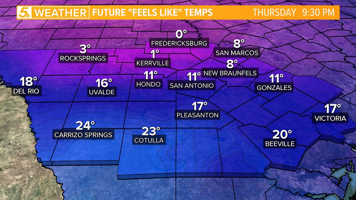
Once the Wind Chill Advisory begins, wind-chill temperatures will be in the teens, around 11 degrees by 9:30 p.m. This is a combination of temperatures in the 20s and breezy winds gusting around 30 mph.
Friday morning is expected to be even colder.

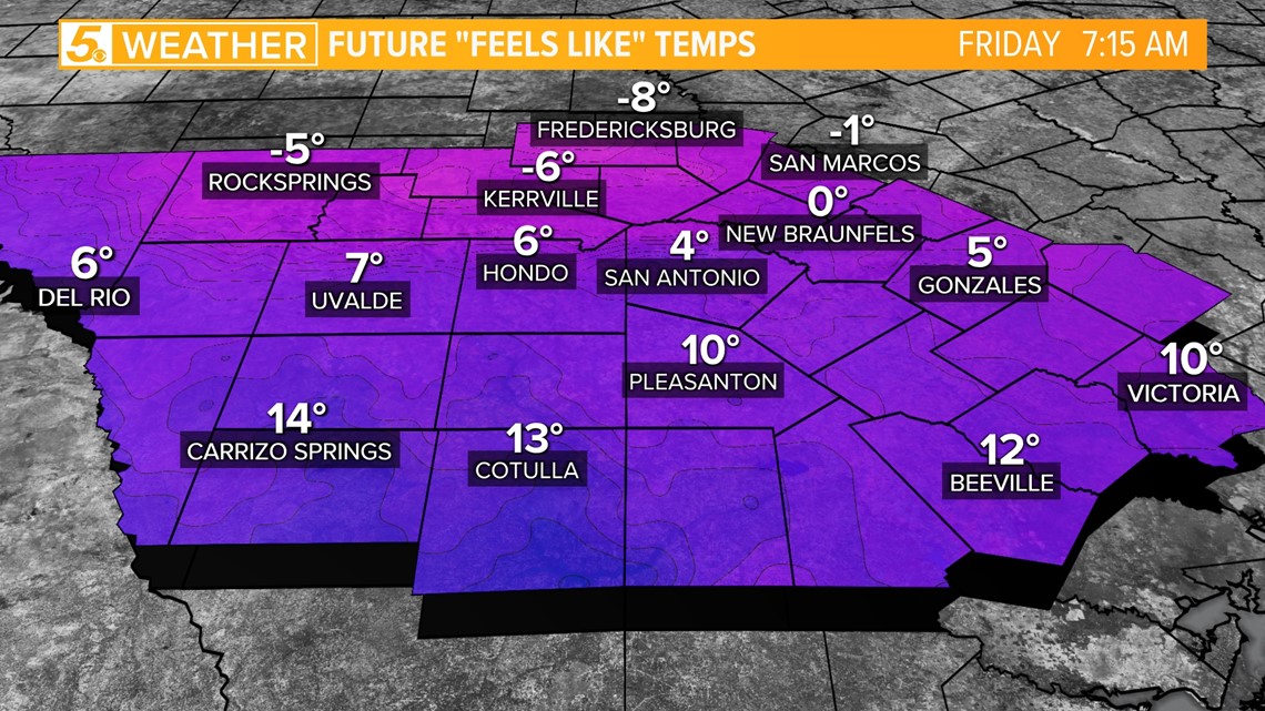
Since temperatures will continue to drop overnight Thursday, San Antonians will wake up to temperatures feeling like 4 degrees, thanks once again to the wind chill. Yes, that's right: single digits!
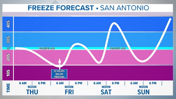
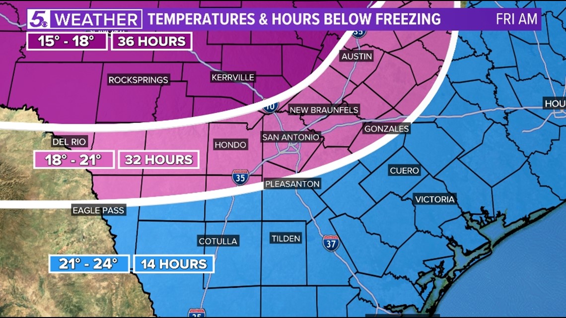
The Hill Country will see temperatures below zero degrees at -8 degrees in Fredericksburg. This will lead to a hard freeze in San Antonio and the Hill Country, prolonging the frigid conditions which will have stuck around for over 32 hours by the time Friday morning arrives. Drip those faucets!

These frigid temps should warm up by Friday afternoon, however it could be a struggle. If temperatures reach above 32 degrees then much of the ice on power lines and roadways will have a chance to melt. If not, San Antonians will have to wait one more night.

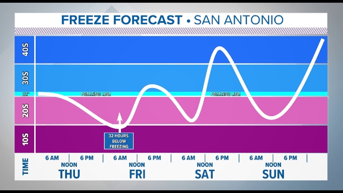
Friday night and Saturday night San Antonians can expect another hard freeze with temperatures dropping into the 20s Friday evening and the low-30s Saturday evening.
Afternoon highs will continue to rise each day with Friday afternoon seeing the mercury rise into the upper-30s, Saturday in the mid-40s and Sunday in the mid-50s.
How to prepare for the colder weather:
- Stay warm and remember the 4 Ps, including people, pets, pipes and plants.
- Keep a flashlight handy in case of power outages.
- Keep your phones and other electronic devices charged to stay weather informed.