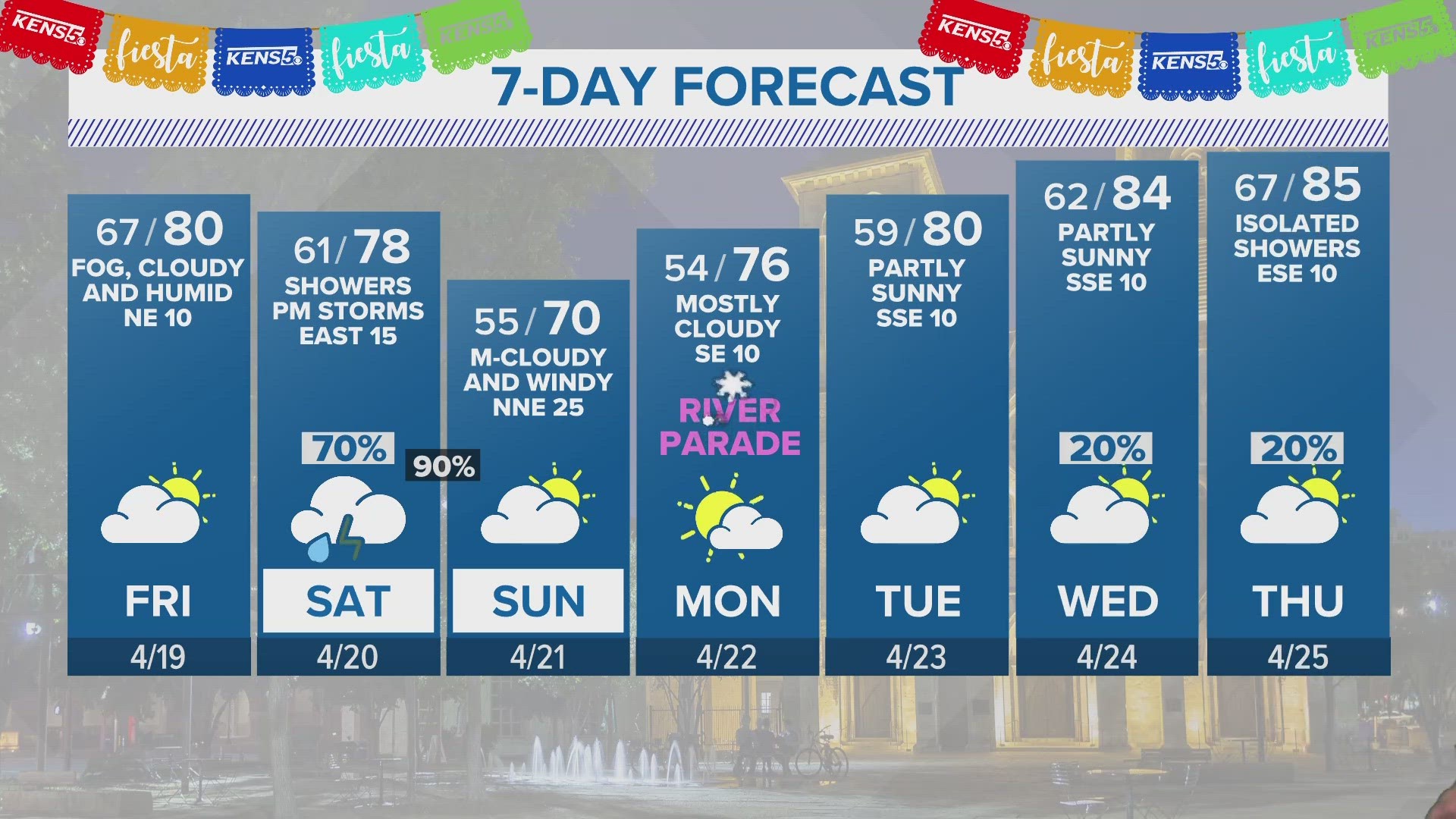
We're looking at about 3 more days of rain, but the rain on Monday night and Tuesday morning should be the worst of it. There's a 50 percent chance of rain Tuesday night.
Storms Tuesday evening should stay south of the city, but there is some lightning near Floresville.
From now until Thursday, expect some scattered showers as temperatures stay relatively low.
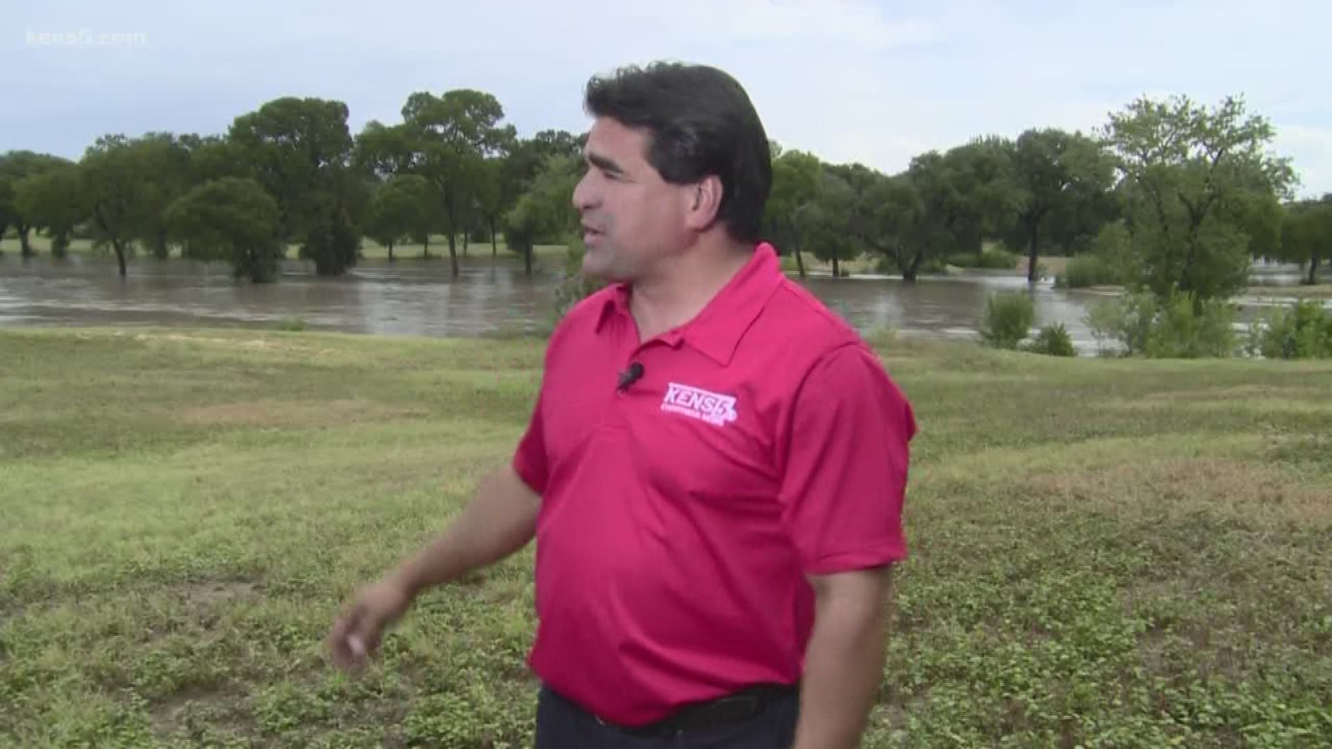
Rain continued into Tuesday afternoon across portions of Kinney, Uvalde, Medina, Frio, Zavala, Maverick and Dimmit counties.
4-9 inches of rainfall has fallen within the watch area since Sunday evening, and another 2 to 5, with isolated higher totals, is expected. NWS said this could lead to Flash Flood and River Flood impacts.
San Antonio saw its tenth wettest day in history on Labor Day Monday. As KENS 5 reported, a sudden burst of stagnant, heavy rain dropped six to eight inches of rainfall around the area.
As of Tuesday morning, the main area of concern is west Bexar County.
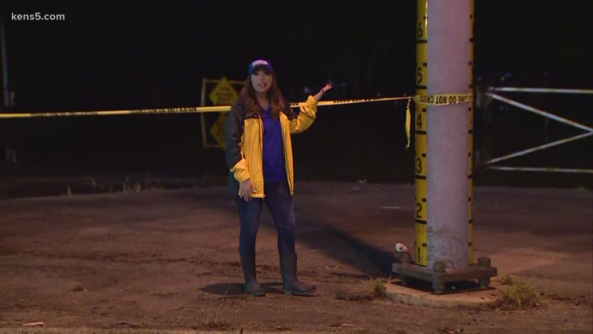
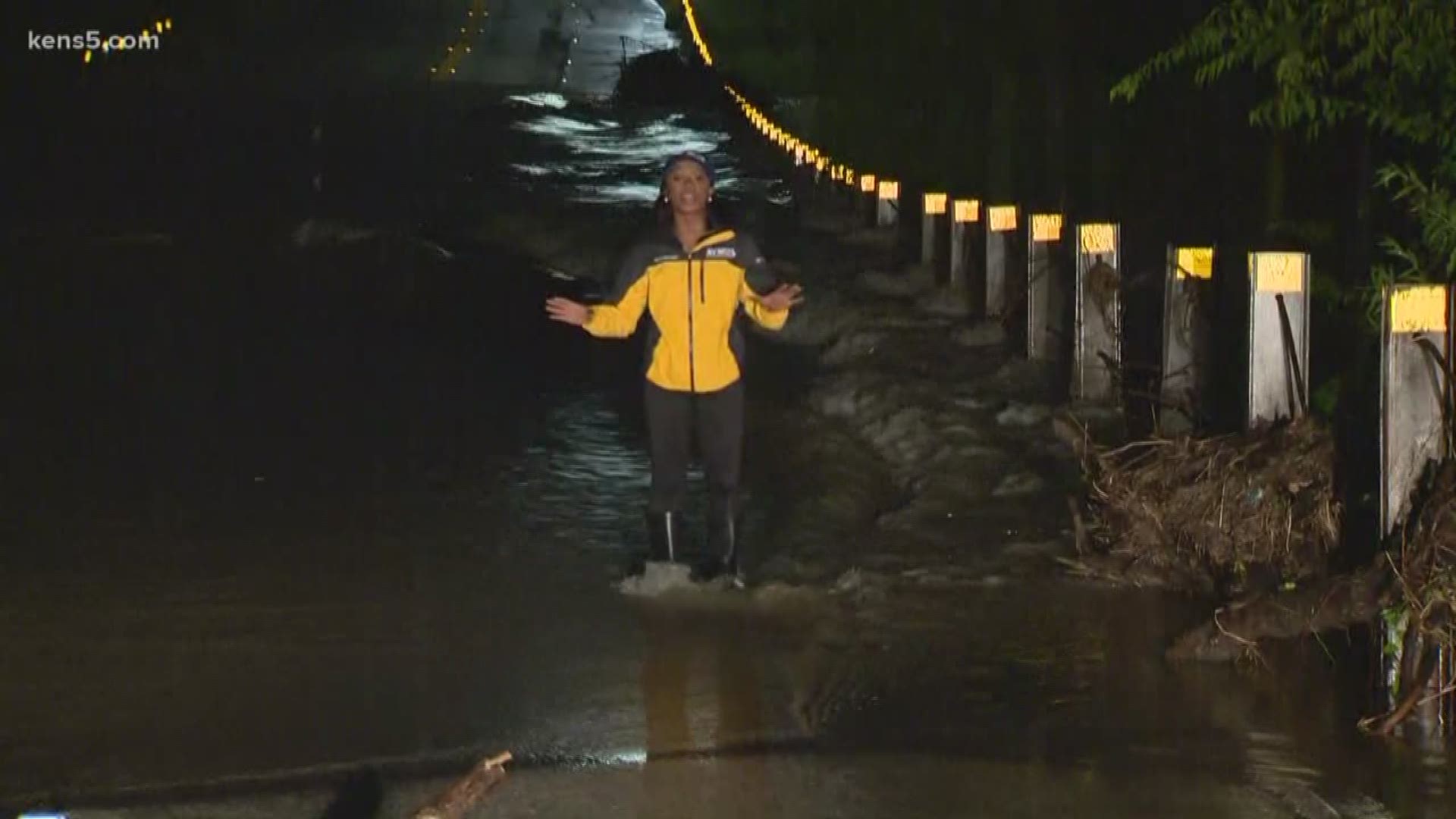
Officials were warning people to avoid driving on the roads if at all possible, and to use extreme caution and avoid high water areas. As of 3:30 a.m., 33 roads were closed, mainly across Northern San Antonio.
As pockets of heavy rain were continuing to move throughout the area, CPS Energy crews had restored power to more than 3,000 customers, although about another 3,028 remained without power.
NWS was also reporting that Labor Day Monday was the tenth wettest day overall and third wettest day in September on record for San Antonio ever.
We can expect rain chances to stick around in the area throughout the week, keeping the daytime high temperatures lower than they were last week.