
COLORADO, USA — With several major wildfires burning in our state and extremely dry conditions, Governor Jared Polis (D-Colorado) on Tuesday announced a statewide fire ban. It will remain in place for 30 days and prohibits all open burning and fireworks.
Smoke from wildfires in Colorado and California will affect the air quality along the Front Range on Monday. An air quality alert is in place for increased ozone levels and heavy wildfire smoke again on Monday. At times, the air quality will be "unhealthy," so take it easy if you're spending time outside.
A new article on current wildfires in Colorado was published Oct. 19. This article is not longer being udpated.
Below is a list of all the large fire currently burning in Colorado.

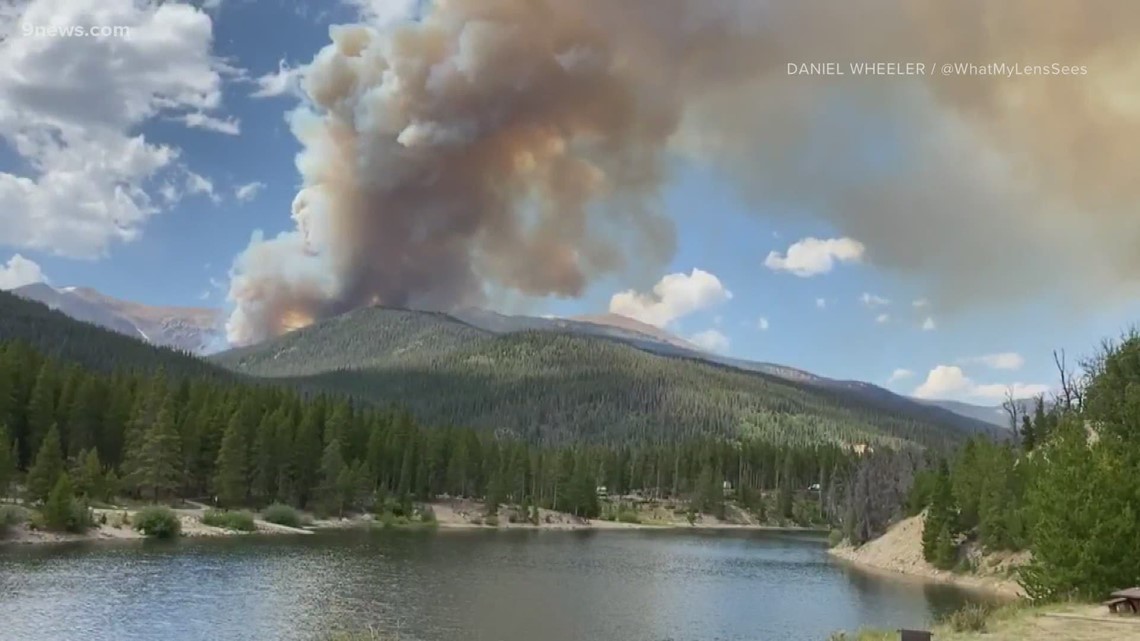
Cameron Peak Fire
Size: 20,118 acres
Containment: 0%
Location: 25 miles east of Walden and 15 miles southwest of Red Feather Lakes near Cameron Pass
Date reported: Aug. 13
Evacuations: Multiple campgrounds have been evacuated and access to State Forest State Park is very limited.
Details: The fire remained active on Sunday due to hot, dry, and windy conditions. The southeast area of the fire continued to have the most activity as it moved south of Peterson Lake. The fire also progressed north of the West Fork Tunnel area, fire officials said Sunday, Aug. 23.

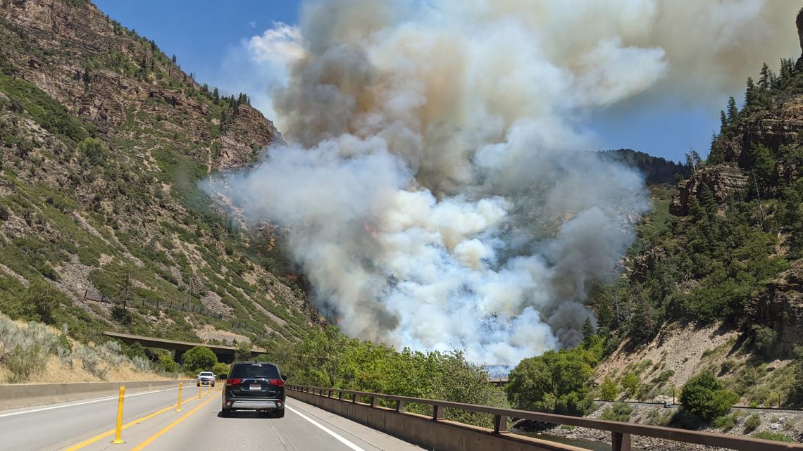
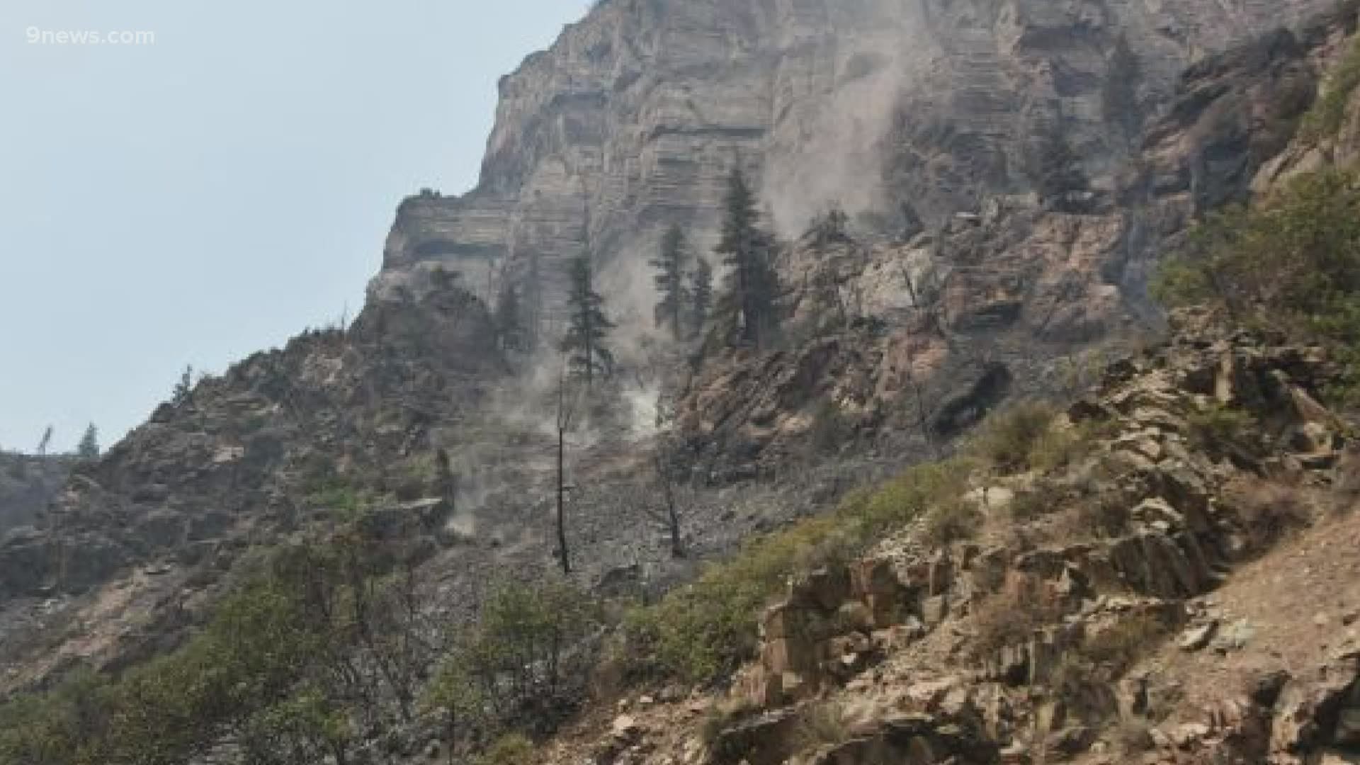
Grizzly Creek Fire
Size: 30,719 acres
Containment: 30%
Location: Glenwood Canyon
Date reported: Aug. 10
Evacuations: The No Name evacuation was lifted at 4 p.m. on Sunday, Aug. 23. Residents were notified and allowed to start returning home.
The pre-evacuation notice for the residents of Garfield County living in the Sweetwater area has been lifted.
Details: Smoke from the fire is still visible, but is propagating from the higher areas above the canyon rim. With more hot and dry weather in store on Monday, firefighters can expect active fire behavior.
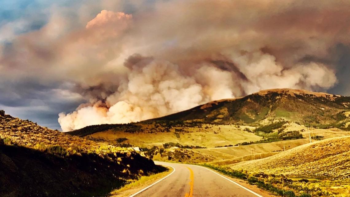
Pine Gulch Fire
Size: 133,783 acres
Containment: 44%
Location: 18 miles north of Grand Junction
Date reported: July 31
Evacuations:
Areas currently under evacuation orders are:
- Garfield County: 4A Ridge Road (256), Salt Wash (205), King Road (258), Clear Creek Road (211), Carr Creek Road (207), Kimball Creek Road (202).
Pre-evacuation notice:
- Garfield County: Everything west of Douglas Pass (CO Hwy 139) to the Utah state line.
- Any formerly evacuated residents remain in pre-evacuation.
Details: Active fire behavior continues due to historically dry conditions and receptive fuels. Excessive heat warnings continue throughout western and central Colorado.

Williams Fork Fire
Size: 11,048 acres
Containment: 3%
Location: Near Hot Sulphur Springs on County Road 30 south of Williams Fork Reservoir.
Date reported: Aug. 14
Evacuations: The Williams Fork Fire Pre-Plan Map for pre-planning and preparation purposes is available for public use. There are no standing evacuation orders for residential areas, including the Fraser Valley. For the most current information and to sign up for CodeRED Emergency Notifications please go to www.gcemergency.com.
Details: Smoke settled into the communities of Parshall and Kremmling on Sunday, bringing unhealthy to very unhealthy conditions to these areas. The fire is actively burning in the Horseshoe Lake and Darling Creek areas.
Thorpe Fire
Size: 150 acres
Containment: 0%
Location: Park County, South Park Ranger District, off FSR 230 and Park County Road, west of Lake George and two miles southwest of Tarryall.
Date reported: Aug. 23
Evacuations: Mandatory evacuations for campers off of CR 31 and surrounding Forest Service roads as well as two subdivisions Weber Park area.
Pre-Evacuation and Evacuation information can be found on the Park County website. Forest Service Roads 227 and 231 and County Road 44 are closed.
Lewstone Fire
Size: 165 acres
Containment: 0%
Location: Between Highway 14 and Rist Canyon Road, about 3 1/2 miles west of U.S. 287 in Larimer County
Date reported: Aug. 22
Evacuations: The latest evacuation issued on Sunday afternoon for the Stratton Park Road area north of Rist Canyon Road (County Road 52E) is voluntary, Larimer County Sheriff's Office said.
Evacuations for Whale Rock Road west to Davis Ranch Road have been downgraded to voluntary evacuations, the sheriff's office said.
Red Canyon Fire
Size: 30-40 acres
Containment: 100%
Location: Near Spring Valley which is located about 8 miles north of Carbondale and about 9 miles south of Glenwood Springs.
Date reported: Aug. 19
Evacuations: None, evacuations have been lifted
Details: Fire crews said they are making "excellent progress' on the fire.
Stull Mountain Fire
Size: .65 acre
Containment: 100%
Location: In Custer County three miles north of McKenzie Junction, west of Wetmore, Colorado.
Date reported: Aug. 18
Evacuations: None
Details: Two Forest Service engines and one squad were ordered to battle this remote fire, along with one airtanker. Lightning sparked the fire, according to the U.S. Forest Service.
Grape Creek Fire
Size: 1 acre
Containment: 100%
Location: Two miles southeast of Florissant in Park County.
Date reported: Aug. 18
Evacuations: None
Details: Two Forest Service engines and one squad were called to battle this lightning-caused fire, which is burning in Ponderosa and tall grass.
Goose Creek Fire
Size: 171 acres
Containment: 85%
Location: 13 miles south of Creede.
Date reported: June 28
Evacuations: None
Details: Rain has helped firefighters get a handle on this blaze, though pockets of heat will likely persist for the foreseeable future. A crew of six firefighters are on the scene to take care of potential flareups.
SUGGESTED VIDEOS: Colorado wildfires