
ORANGE COUNTY, Texas — Officials with the National Weather Service have confirmed to 12News that an EF-1 and an EF-2 tornado touched down in Orange County during Tuesday’s severe storms.
The NWS reports that wind speeds in the EF-1 tornado near Bridge City were estimated to be 100 mph. The tornado near Orangefield had wind speeds of 120 mph.
The EF-1 tornado touched down in the Bessie Heights Marsh area, damaging trees and some roofs from Nora Circle across West Round Bunch Rd and Edgar drive to Turner Road near Bridge City.
The tornado damaged electric transmission lines as it weakened before Bessie Heights Rd.
The “Enhanced Fujita Scale, or EF Scale, assigns a “rating” based on several factors including estimated wind speeds and related damage on the scene according to the weather service website.
When the NWS surveys potential tornado damage they compare it to a list of “damage indicators” and “degrees of damage” so that officials can estimate the range of wind speeds the tornado likely produced.
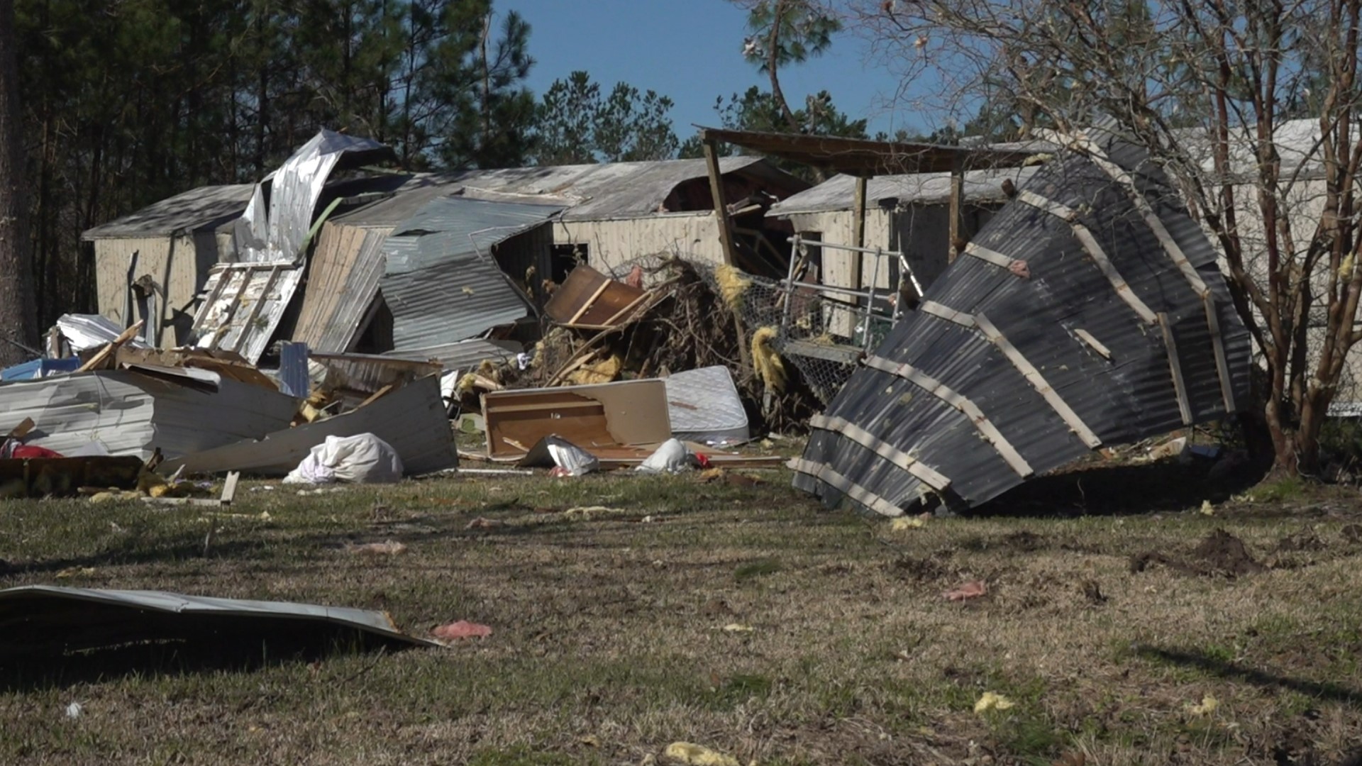
Neighbors along Sandbar Road in Orangefield have spent another day cleaning up after the EF-2 tornado ripped through their street Tuesday night.
The Marcantel brothers say it all happened so fast.
"The alert hit on my brothers phone and it hit so quick. My sister-in-law ran and screamed to the bedroom. He was trying to get to her, and it all happened so quick," they said.
Elton Homes was right in the path of the EF-1 tornado that touched down near Bridge City.
"From a hurricane or a tornado, I would pick a hurricane because with a hurricane you at least have time to get away from it. It came so fast. I looked at my phone and saw the alert, next thing I was losing my roof," Home said.
12News drove along with Meteorologist Doug Cramer from the National Weather Service as he followed the exact path of the tornadoes.
While taking measurements, pictures and collecting data, Cramer is trying to answer some key questions.
"We didn't expect it initially, but we are on a damage path right now, that started in the marsh and came over here towards Turner Road. Now, this is going to be a larger and separate path from the larger tornado out in Orangefield," Cramer said.
Cramer and his team are still investigating several other reported tornadoes in the area.
A supercell that traveled from Wharton and Harris County to Jefferson and Orange County produced multiple reports of tornadoes along its path Tuesday.
In Southeast Texas “tornado damage signatures” on Doppler radar showed the possibility of several tornados in Nome, Taylor Landing, Groves, Orange, Orangefield and the Bessie Heights Marsh area near Bridge City.
Just a little over a year ago, in October 2021, four tornadoes ranging from an EF0 to a pair of EF2 tornadoes touched down in Orange County.
An EF2 tornado, with peak wind speeds of 130 mph, touched down south of Old Highway 90 near the Highway 62 exit on Interstate 10 in Orange, according to an NWS report.
That tornado could be compared to a category three hurricane regarding damage potential, said Roger Erickson of the NWS. No injuries or fatalities were reported from this tornado. The tornado lasted about 6 minutes long.
The other EF 2 tornado began near Highway 1130 in Orange and later crossed into Newton County. Upon its initial touchdown, that tornado flipped a mobile home, trapping and critically injuring woman inside.
At its peak the tornado reached winds 130 miles per hour. Its duration was about 14 minutes long.
A brief EF 0 tornado touched down west of Nick Avenue in Port Acres. It brought structural damage to buildings and homes and blew numerous limbs off trees. No fatalities or injuries were reported in connection to this tornado.
At its peak the tornado reached winds of 80 mph. Its duration was approximately one minute long.
A tornado categorized as an "EF-unknown" touched down briefly in Bessie Heights. An NSW report said, "there is no way to survey this area."
In 2004, an elderly woman was killed when several EF 1 and EF 2 tornadoes hit Hardin and Tyler Counties, damaging homes and knocking down trees.
One of the worst tornado outbreaks in Southeast Texas happened in 1957 when 14 different tornadoes touched down in Jefferson and Orange County and Southwest Louisiana over a 10-hour period according to weather service records.
In this outbreak the F4 tornado that struck Orange is the strongest tornado to ever touch down in Southeast Texas. There was also an F4 tornado that struck Groves on the same day causing heavy damage.
The original Fujita Scale, developed in 1971, was updated to the “Enhanced Fujita Scale” in 2017 to align wind speeds more closely with associated storm damage according to the weather service.
The scale uses wind estimates based on damage instead of actual wind measurements. It estimates three-second gusts where the damage happened. Officials base these on 28 damage indicators, each with their own eight levels of damage to consider.
It is important to note that the three-second gust is not the same wind as in a “standard surface observation.” Standard wind measurements are made by weather stations in “open exposures” and directly measure “one minute mile” speed according to the Weather Service.
You can read all about the scale and each of the 28 damage indicators of the enhanced scale at Weather.gov.
GET NEWS & WEATHER ALERTS | Download the 12News App to your mobile device
This is a developing story. We will update with more if and when we receive more confirmed information.